Missouri Trails To The Past
Forts at Cape Girardeau
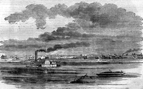 Cape Girardeau Forts (1861-1865) - Cape Girardeau, sitting on
the first continuous high ground in Missouri upstream of the
Ohio River, was deemed an important site during the Civil War
for numerous strategic reasons. In 1861 General Ulysses S. Grant
approved the construction of four forts at strategic locations
around the city of Cape Girardeau. They were named Forts A, B,
C, and D.
Cape Girardeau Forts (1861-1865) - Cape Girardeau, sitting on
the first continuous high ground in Missouri upstream of the
Ohio River, was deemed an important site during the Civil War
for numerous strategic reasons. In 1861 General Ulysses S. Grant
approved the construction of four forts at strategic locations
around the city of Cape Girardeau. They were named Forts A, B,
C, and D.
Fort A was positioned on a bluff overlooking the Mississippi River at the north edge of town and was meant to defend the city against Confederate gunboats on the river. The site was located north of present day Bellevue Street between Lorimier and Spanish Streets. There is nothing left of fort today.
Fort B was located on a hill now occupied by Southeast Missouri State University and was built to protect the city from enemy approaches on the Perryville Road and Jackson Road (now Broadway Avenue). The fort was open-sided, with earthworks on the north and west sides. It was well-armed with howitzers and 24 lb siege guns. Nothing is left of the fort today, but a monument marks the site.
Fort C was near the present intersection of South Ellis Street and Good Hope Street. Guarding approaches on the Bloomfield Road, Gordonville Road (now Independence Street), and Commerce Road (now Sprigg Street), controlling access to the city. During the Battle of Cape Girardeau, Confederate forces stayed out of range of the fort's cannons. Though there is nothing left of the fort today, a monument marks the site.
 Fort D was located on a river bluff south of the city, and like
Fort A, it was primarily a river defense. It was the largest and
most important garrison in the region and is the only fort
remaining in Cape Girardeau today. The post was constructed by
Union troops at the same time as the other Cape Girardeau forts
in 1861. Like the others, Fort D was designed by Captains Franz Kappner and Henry Fladd of the Army Engineers. Construction
began on August 6, 1861, under the direction of Lieutenant John
W. Powell from Illinois. The design is in a French bastion form,
a triangle with open base. The earthworks faced away from the
river. Reportedly, Fort D housed both 24 and 32-pound cannons,
which would easily control any upriver movement on the
Mississippi River.
Fort D was located on a river bluff south of the city, and like
Fort A, it was primarily a river defense. It was the largest and
most important garrison in the region and is the only fort
remaining in Cape Girardeau today. The post was constructed by
Union troops at the same time as the other Cape Girardeau forts
in 1861. Like the others, Fort D was designed by Captains Franz Kappner and Henry Fladd of the Army Engineers. Construction
began on August 6, 1861, under the direction of Lieutenant John
W. Powell from Illinois. The design is in a French bastion form,
a triangle with open base. The earthworks faced away from the
river. Reportedly, Fort D housed both 24 and 32-pound cannons,
which would easily control any upriver movement on the
Mississippi River.
Soldiers who served at the fort reported that "Quaker" cannons (logs painted black) were used to enhance the appearance of the armament. In order to keep warm during the winters, soldiers dug artificial caves in the hillside below the fort. Fort D did not see action during the Battle of Cape Girardeau and probably never fired it guns in anger, serving mostly as a symbolic deterrent.
In 1936, the site was purchased by the American Legion post, and the earthworks were restored to their original height, with some modifications. A stone building, constructed in the middle of the fort at the site of the original powder-house, was dedicated to the city and today is part of the City of Cape Girardeau Parks & Recreation Department.
he earthwork walls remain intact and historical signage throughout the fort's grounds bring its storied past to life. Fort D is located at Fort Street and Locust Street in Cape Girardeau. The fort is open daily from dawn to dusk.
Lieutenant John W. Powell was in charge of the various forts for some months, recruiting local citizens in Cape Girardeau who were mustered in as Battery F, 2nd Illinois Artillery. With his troops, he fought at the Battle of Shiloh in Tennessee, where he lost his arm. After the Civil War, he became famous as the leader of the first expedition to successfully navigate the Colorado River through the Grand Canyon.
http://www.legendsofamerica.com/mo-capegirardeaufortsbattle.html